Digital Solutions to Real World Problems
At Spatial-Hub, we bring extensive experience in the geospatial industry to deliver innovative, high-impact solutions across the environmental, social, and engineering sectors worldwide. Driven by a passion for excellence, we harness cutting-edge technologies in Geographical Information System (GIS), remote sensing, machine learning, surveying, flood modeling, digital twins, 3D, smart city, information modeling etc. to transform data into actionable insights. Our mission is to shape the future of spatial intelligence by pushing the boundaries of geospatial innovation and helping clients make smarter, data-informed decisions
Our Services


What we do
We provide cutting-edge services for GIS and remote sensing tailored for social, economic and environmental sectors. GIS system services enterprise hosting and Web mapping. We turn complex data into actionable insights, empowering clients to make informed decisions
Domain Applications

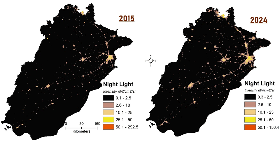
Tracking Socio-economic Development using Temporal Satellite data
Count: 598