On the banks of the Ravi, Lahore has always lived with the risk of flooding. But in August 2025, that risk turned into reality.
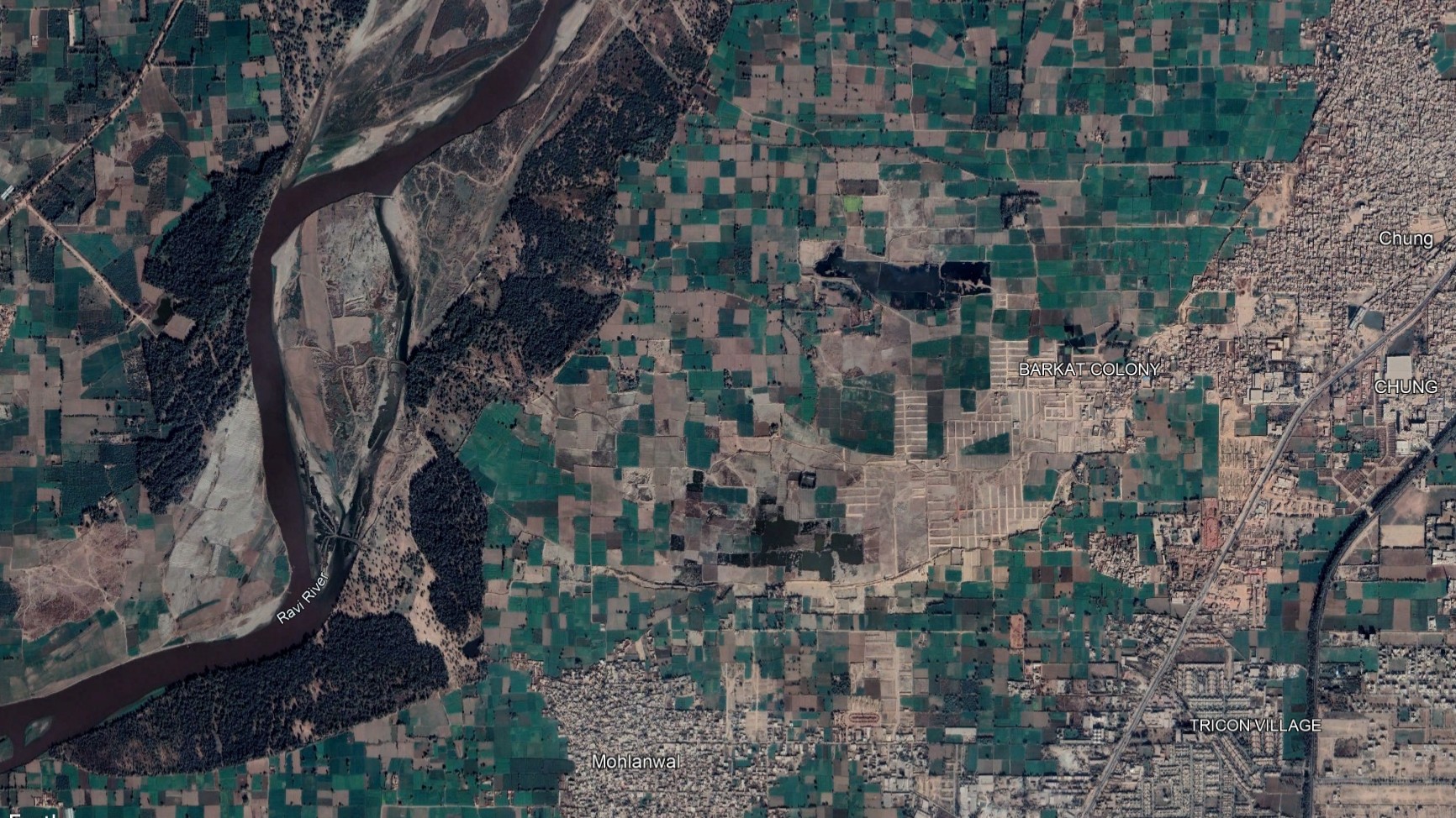
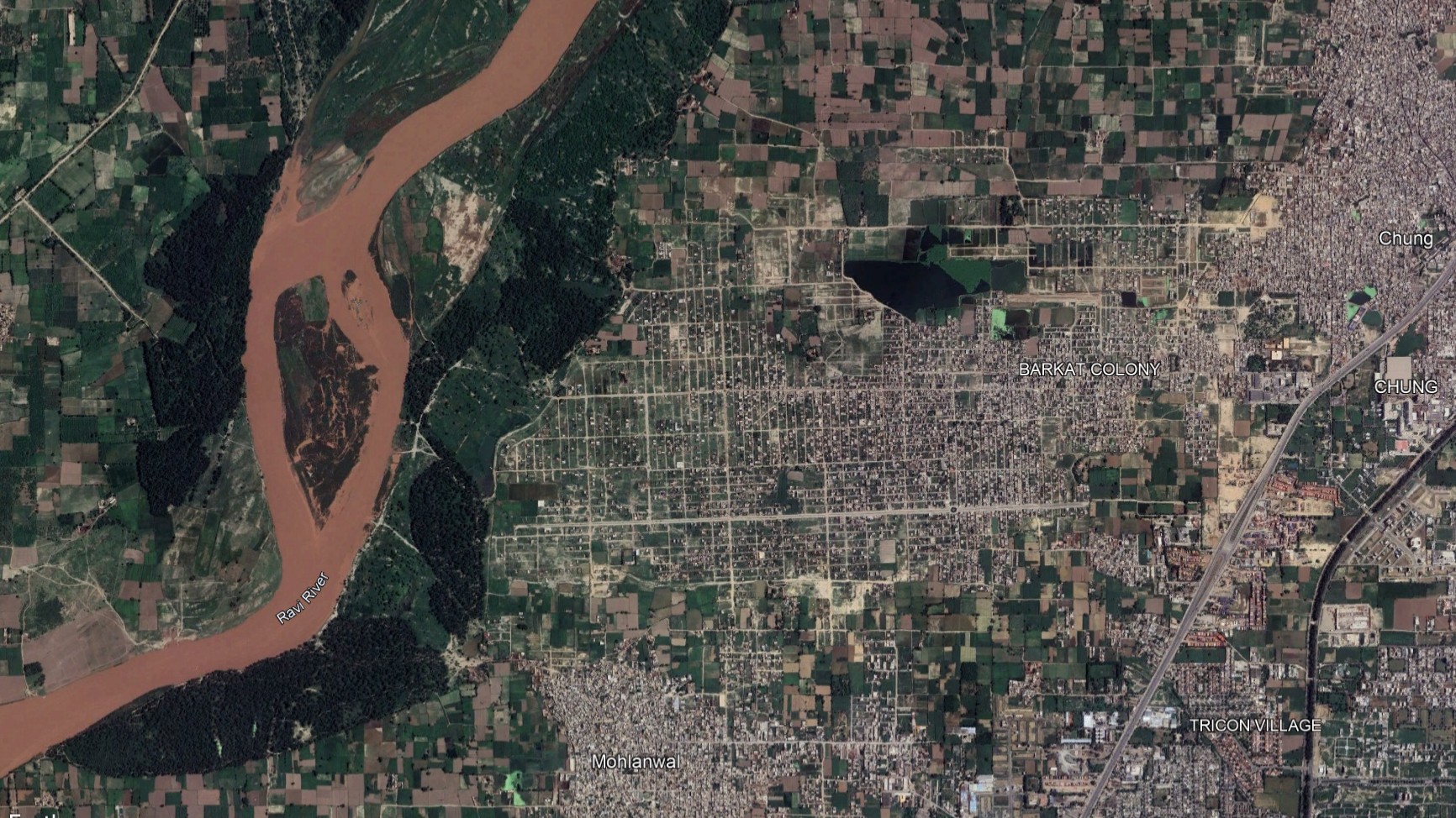
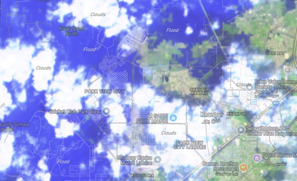
Using Google Earth imagery and ground reports, I created a time slider map showing two housing societies—Barkat Town and Park View Housing Society—developments during 2018-2025. The visual contrast is stark: from orderly neighborhoods to waterlogged islands.
🚨 What Happened?
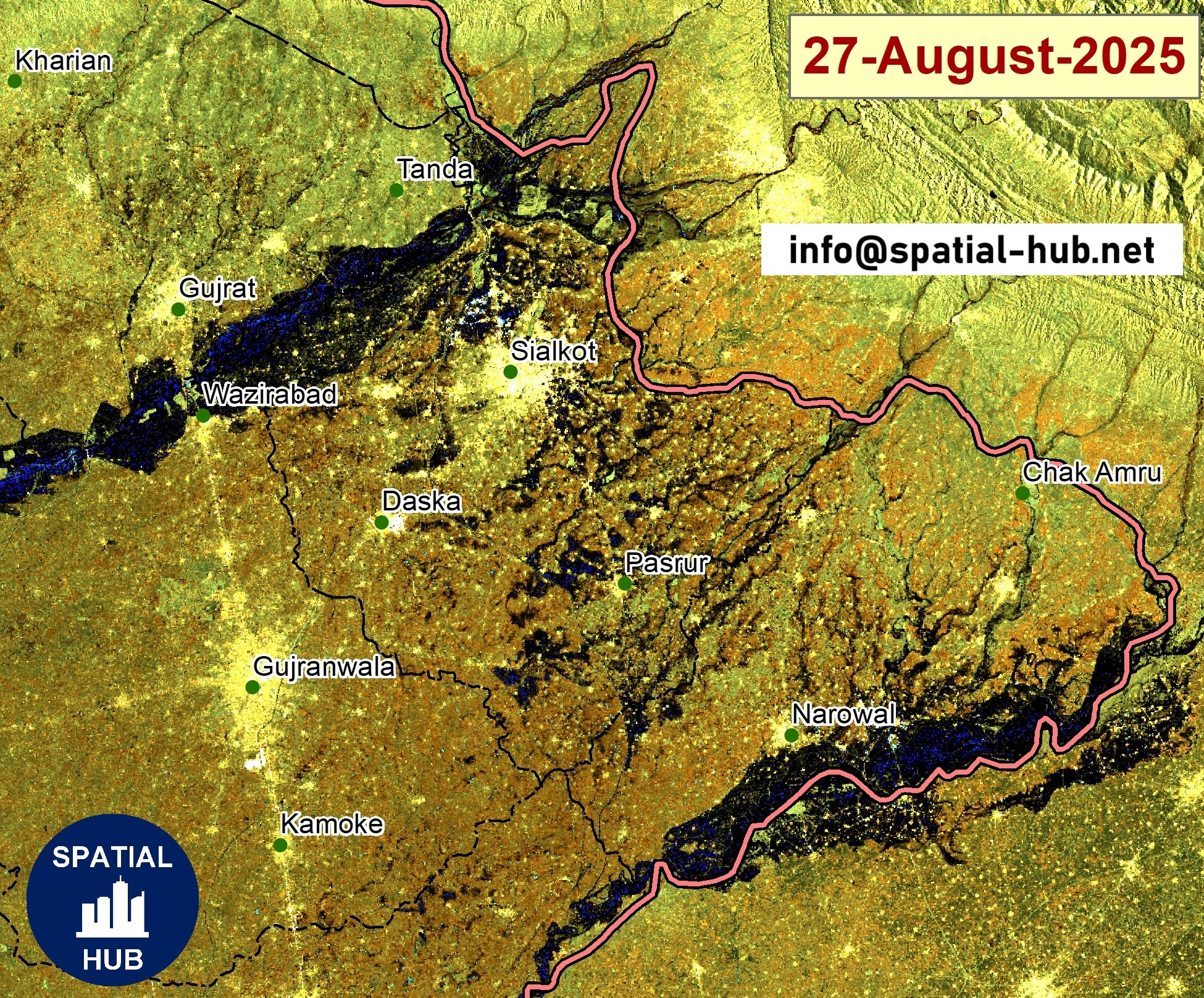
On August 29, 2025, the Ravi River swelled to nearly 220,000 cusecs, just short of its 250,000 design capacity. This was the highest water flow since the infamous 1988 floods, which devastated much of Lahore.
The pressure was too much for embankments. Water surged into residential zones:
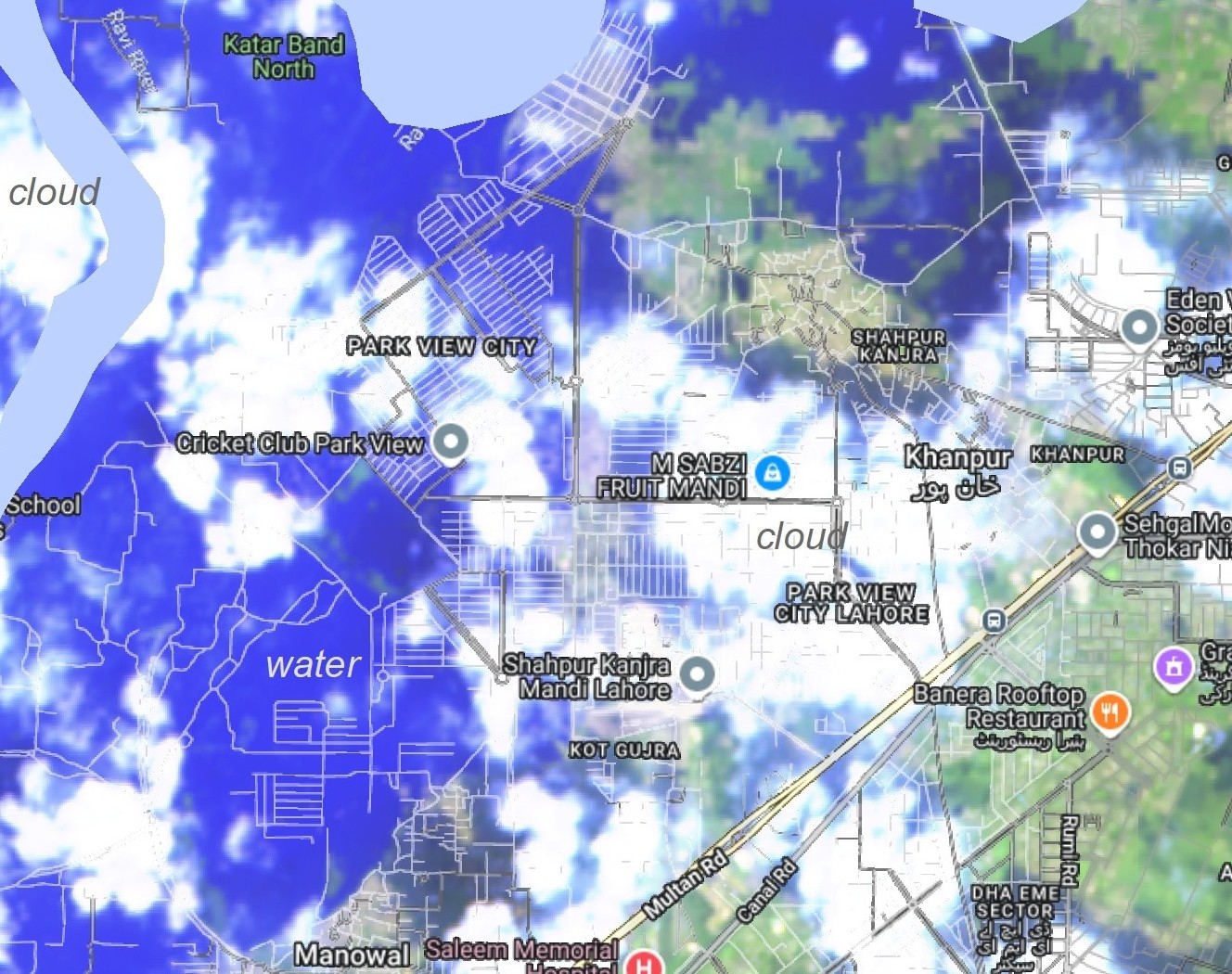
- Park View Housing Society
- Floodwaters entered multiple blocks, including Diamond, Overseas, and Platinum.
- Depth reached up to 5 feet inside homes overnight.
- More than 2,000 residents were evacuated, many moved to relief camps set up in schools.
- Management promised relief and compensation, deploying on-ground teams 24/7.
- Barkat Town
- A lower-income settlement along the Ravi’s floodplain.
- Streets and homes were completely submerged; electricity supply was cut to prevent accidents.
- Families lost household items and livestock, with limited resources to recover quickly.
- Evacuations were supported by Rescue 1122 boats and volunteer efforts, highlighting the community’s resilience.
⏳ The Time Slider: 2018 vs 2025
- 2018: Barkat Town and Park View stood as growing residential communities, home to thousands—planned and unplanned, yet full of life.
- 2025: The slider reveals rapid urbanization in river bed. What was once urban expansion now are temporary lake.
This contrast isn’t just visual. It’s a reminder of how rapid urbanization into floodplains can turn thriving societies into disaster zones overnight.
Barkat Town
Park View Housing Society
🌧️ Why It Matters
Experts link this year’s floods to a triple trigger:
- Glacial melt from the north,
- Intense monsoon rains, and
- Upstream water release from India.
But beyond natural forces lies a deeper issue: poor land-use planning. Societies like Barkat Town and Park View were built on historically flood-prone land. Without robust embankments, zoning enforcement, or drainage infrastructure, residents were left exposed.
✅ Lessons for Lahore
The 2025 floods carry three urgent lessons:
- Data for Action: Satellite tools like MODIS and Sentinel imagery must guide urban planning.
- Resilient Infrastructure: Housing societies need proper embankments, storm drains, and safe zones.
- Policy Enforcement: Floodplain construction cannot continue unchecked.
📢 Final Word
The story of Barkat Town and Park View is not about one flood—it’s about how we plan for a climate-uncertain future.
The time slider map you see here is more than a visual—it’s a warning. Urban Lahore must choose resilience over risk, or we will keep repeating this cycle of loss.
🌍 At Spatial-Hub.net, we are committed to using Earth Observation and GIS to support climate-smart planning and disaster preparedness.