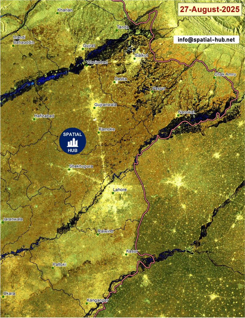
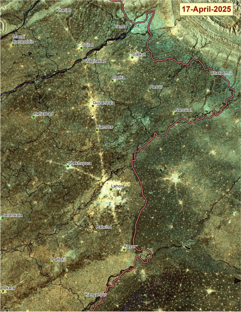
On August 27, 2025, parts of Lahore, Kasur, Sialkot, and Wazirabad face one of the most severe flood emergencies in recent years. My team at Spatial-Hub.net analyzed Sentinel imagery of the region, and the results clearly show vast swathes of Punjab inundated by swollen rivers and backflow from reservoirs.

🚨 The Situation on the Ground
- According to NDMA, over 210,000 people have been evacuated across Punjab, with rescue operations still ongoing.
- The Pakistan Army is active in eight districts, including Lahore, Kasur, Sialkot, and Hafizabad, providing relief and evacuation.
- In Sialkot alone, 133 villages are under water, while Kasur and Okara face devastation from the Sutlej River, displacing more than 380,000 residents.
- The Chenab River has submerged 333 villages, and the Ravi River has affected another 101 villages, forcing thousands from their homes.
🌧️ What Lies Ahead
- The Flood Forecasting Division (FFD) warns of “very high to exceptionally high” water levels in the Sutlej and Ravi rivers in the coming days.
- Lahore’s Shahdara belt is on high alert as floodwaters in the Ravi may worsen over the next 24–48 hours.
- Heavy monsoon rains are expected from August 29 to September 2, likely intensifying the crisis.
- Downstream, the Indus at Guddu and Sukkur is projected to reach very high flood levels by September 4–5.
🔍 The Bigger Picture
Experts point to a dangerous combination of:
- Glacial melt in the north,
- Intense monsoon rainfall, and
- Upstream water release from India.
Prime Minister Shehbaz Sharif has noted that while floods are natural disasters, unregulated construction, weak embankments, and poor land-use planning have worsened the damage. This crisis highlights the urgent need for climate adaptation, better flood zoning, and resilient infrastructure planning.
🛰️ Why Earth Observation Matters
The map I produced using MODIS Aqua imagery shows how quickly floodwaters spread across river basins. Satellite monitoring enables:
- Real-time flood mapping,
- Damage and risk assessment,
- Guidance for evacuation planning, and
- Policy support for climate resilience.
At Spatial-Hub.net, we specialize in using remote sensing and GIS to provide such insights for disaster management, urban resilience, and climate-smart planning.
✅ Final Word
The Punjab floods of 2025 are not just a natural calamity—they are a climate and governance challenge. With over half a million people affected and water levels still rising, urgent coordinated action is needed to save lives and rethink how we plan our cities and manage our rivers.

Count: 596
